Solar Panel
Condition MonitoringBKG Aerial Imagery thermal imaging detects defective panel cells, connection points & complete arrays that form individual electrical phases. BKG Aerial Imagery provides an efficient method of validating new installations & helps to maintain maximum output from aging infrastructures.Contact With UsWind Turbine
Condition Monitoring
BKG Aerial Imagery wind turbine condition monitoring service is game-changing. Our condition monitoring service conducted via drone is 2-4 times faster than traditional methods & provides significant cost savings and improved safety by reducing work at height.Contact With UsRoof & Facade
Condition Monitoring
BKG Aerial Imagery quickly & safely inspects building roofs & facades providing accurate observations & data for condition assessments. BKG Aerial Imagery collects the aerial images & data, which can include 2D & 3D models of the infrastructure & property to inspect any damaged areas.Contact With UsObservations &
Data for InsuranceStreamline claims adjustment & underwriting. It’s important to capture accurate data quickly. BKG Aerial Imagery helps insurance companies quickly collect aerial data, which is ideal for roof inspection, damage repair & claims adjustment.Contact With Us
Previous slide
Next slide
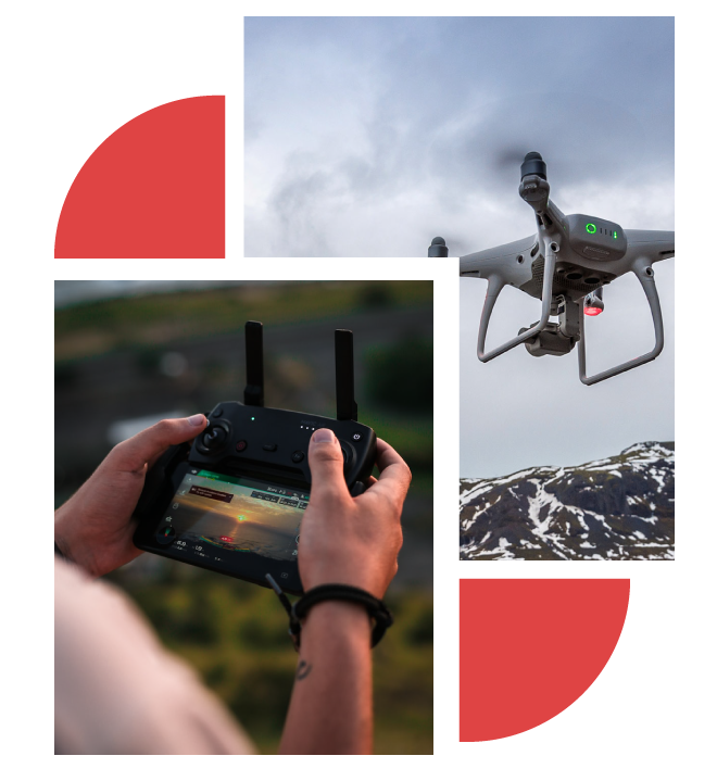
BKG Aerial Imagery
Turnning Passion Into Safety
Imagine reducing your company’s liability, boosting its competitiveness, and increasing profitability, all while keeping your employees safe. This is what we offer. Our drone technology enables your employees to analyze data and produce deliverables without exposing themselves to unnecessary hazards.
My endeavor is to take the risk out of your hands and replace it with productivity. With the right blend of drones, cameras, and software, we provide a risk-free, top-notch service that helps our clients not only save on insurance expenses but also optimizes their efficiency – a win-win for everyone.
Beyond safety, we also extend hands-on training to your employees, catering to your specific needs and adjusting our offerings to suit your end-user requirements.
Contact With Us
Our Services
OUR SERVICE DEPARTMENT
IS HERE FOR YOU

MAPPING FOR SURVEYORS AND ENGINEERS
At BKG Aerial Imagery, we specialize in providing cutting-edge mapping services tailored to meet the unique needs of surveyors and engineers.

OBSERVATIONS AND DATA FOR INSURANCE
BKG Aerial Imagery delivers a game-changing advantage in insurance with our Observations and Data services. Harness the power of high-resolution aerial imagery for precise property

Inspections and Observation services
BKG Aerial Imagery takes your inspections to new heights with our cutting-edge Inspections and Observation services. Utilizing advanced aerial technology

IMAGERY
BKG Aerial Imagery offers a sky-high perspective with our premier Imagery services. Elevate your projects with high-resolution aerial views that provide unparalleled detail

SEARCH AND RESCUE
BKG Aerial Imagery pioneers Search and Rescue operations with innovative aerial solutions. Our advanced technology enhances search efforts by providing high-resolution imagery, optimizing
MAPPING FOR SURVEYORS AND ENGINEERS
At BKG Aerial Imagery, we specialize in providing cutting-edge mapping services tailored to meet the unique needs of surveyors and engineers.
OBSERVATIONS AND DATA FOR INSURANCE
BKG Aerial Imagery delivers a game-changing advantage in insurance with our Observations and Data services. Harness the power of high-resolution aerial imagery for precise property
Inspections and Observation services
BKG Aerial Imagery takes your inspections to new heights with our cutting-edge Inspections and Observation services. Utilizing advanced aerial technology
IMAGERY
BKG Aerial Imagery offers a sky-high perspective with our premier Imagery services. Elevate your projects with high-resolution aerial views that provide unparalleled detail
SEARCH AND RESCUE
BKG Aerial Imagery pioneers Search and Rescue operations with innovative aerial solutions. Our advanced technology enhances search efforts by providing high-resolution imagery, optimizing
How It Works
Follow Easy Steps

Request a Drone Mission
Online or by Phone
01

02
Our Certified and Insured
Pilots Do The Flying

We Deliver Your Aerial
Content Digitally
03
About
BKG Aerial Imagery
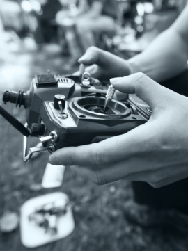
Every journey starts with a step, and mine began at the crossroads of passion and necessity. Years ago, I was just another professional in the construction industry, navigating through the challenging realm of heights, harnesses, and hard hats. My daily routine was a delicate ballet of managing environmental elements while seeking to gather accurate data. But, my life took a fascinating detour when I discovered the world of drones.
‌Initially, it was just a hobby, a pastime that unwound me after a hard day’s work. But as I delved deeper into the realm of drones, I realized that they could potentially revolutionize my approach to construction management. The drones could capture details that my naked eye missed. They could reach spaces that were tricky for me, and they did so with a precision that was remarkably impressive.
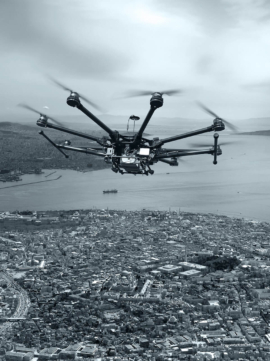
Comparative Analysis of Drone Models
Drone equipment and sales
DJI Mavic 3 Thermal

- Max Flight Time: 45 Min
- Max Transmission Distance: 9.3 Miles
- Max Speed: 47 MPH
- Max Wind Resistance: 39 ft/s
- Water Proof Rating: Not rated
- Visual Sensor Size: 1/2-inch CMOS, 4K
- Infrared Resolution: 640 x 512 Pixels
- Infrared Framerate: 30Hz
- Thermal Imager: Uncooled VOx Micro bolometer
- Infrared Wavelength: 8-14 microm
DJI Matrice 350 RTK

- Max Flight Time: 55 Min
- Max Transmission Distance: 12.4 Miles
- Max Speed: 51.4 MPH
- Max Wind Resistance: 39.4 ft/s
- Waterproof Rating: IP55
- Visual Sensor Size: 1080p
- FPV Camera FOV: 142°
- Frame Rate: 30fps
- Infrared Sensing System FOV: 30° (±15°)
Autel EVO II V3 640T

- Max Flight Time: 40 min
- Max Transmitting Distance: 9.3 Miles
- Max Speed: 44.7 MPH
- Max Wind Resistance: 57.2 ft/s
- Water Proof Rating: N/A
- Visual Sensor Size: 1/1.28″(0.8″) CMOS – 8K Video
- Infrared Resolution: 640×512@25fps
- Infrared Framerate: 30Hz
- Infrared FOV: H33°V26°
- Zoom: 1 – 16x
Teledyne FLIR SIRAS

- Max Flight Time: 31 Min
- Max Transmitting Distance: 6 Miles
- Max Speed: 40 MPH
- Max Wind Resistance: 32.2 ft/s
- Water Proof Rating: IP54
- EO Camera Resolution: 16 MP with 20MP mapping mode, 2MP at 32x zoom
- Infrared Resolution: 640 x 512, radiometric (spot meter, isotherms, ROI)
- Infrared Framerates: 60 Hz
- XT2 Infrared Lens Options: 9,13,19, 25mm
DJI Matrice 30T

- Max Flight Time: 41 Min
- Max Transmission Distance: 5 Miles
- Max Speed: 51.4 MPH
- Max Wind Resistance: 39.4 ft/s
- Waterproof Rating: IP55
- Zoom Camera Sensor: 1/2″ CMOS, 48MP
- Wide Camera Sensor: 1/2″ CMOS, 12MP
- FPV Camera: 1920×1080 at 30 fps
- Thermal Imager: Uncooled VOx Microbolometer
DJI Matrice 300 RTK – Zenmuse H20N

- Max Flight Time: 55 Min
- Max Transmitting Distance: 9.3 Miles
- Max Speed: 51 MPH
- Max Wind Resistance: 49.2ft/s
- Water Proof Rating: IP45
- Visual Sensor Size: 1/1.8″ CMOS; Effective pixels: 4M
- H20N Infrared Resolution: 640×512@30fps
- H20N Infrared Framerate: 30Hz
- H20N Focal Length: 12 mm (f/1.0)
- Thermal Imager:Â
Uncooled VOx Microbolometer
Autel EVO Max 4T

- Max Flight Time: 42 Min
- Max Transmission Distance: 12.4 Miles
- Max Speed: 51.4 MPH
- Max Wind Resistance: 39.6 ft/s
- Waterproof Rating: IP43
- Visual Sensor Size: 1/1.28 CMOS, 50MP
- Thermal Camera Resolution: 640*512
- Thermal Camera Lens: 13mm; Focus: f/1.2
- Thermal Imager: Uncooled VOx Microbolometer
Parrot ANAF USA

- Max Flight Time: 32 Min
- Max Transmission Distance: 3.1 Miles
- Max Speed: 33.6 MPH
- Max Wind Resistance: 49.2 ft/s
- Waterproof Rating: IP53
- EO Image Chain: 21MP 1/2.4″ CMOS
- Visual camera zoom: 32x digital zoom
- Infrared Image Resolution: 320*256Â
- Infrared Framerate: 9 fps (15 fps for ANAFI USA MIL)
DJI Mavic 3 Thermal
- Max Flight Time: 45 Min
- Max Transmission Distance: 9.3 Miles
- Max Speed: 47 MPH
- Max Wind Resistance: 39 ft/s
- Water Proof Rating: Not rated
- Visual Sensor Size: 1/2-inch CMOS, 4K
- Infrared Resolution: 640 x 512 Pixels
- Infrared Framerate: 30Hz
- Thermal Imager: Uncooled VOx Micro bolometer
- Infrared Wavelength: 8-14 microm
DJI Matrice 350 RTK
- Max Flight Time: 55 Min
- Max Transmission Distance: 12.4 Miles
- Max Speed: 51.4 MPH
- Max Wind Resistance: 39.4 ft/s
- Waterproof Rating: IP55
- Visual Sensor Size: 1080p
- FPV Camera FOV: 142°
- Frame Rate: 30fps
- Infrared Sensing System FOV: 30° (±15°)
Autel EVO II V3 640T
- Max Flight Time: 40 min
- Max Transmitting Distance: 9.3 Miles
- Max Speed: 44.7 MPH
- Max Wind Resistance: 57.2 ft/s
- Water Proof Rating: N/A
- Visual Sensor Size: 1/1.28″(0.8″) CMOS – 8K Video
- Infrared Resolution: 640×512@25fps
- Infrared Framerate: 30Hz
- Infrared FOV: H33°V26°
- Zoom: 1 – 16x
Teledyne FLIR SIRAS
- Max Flight Time: 31 Min
- Max Transmitting Distance: 6 Miles
- Max Speed: 40 MPH
- Max Wind Resistance: 32.2 ft/s
- Water Proof Rating: IP54
- EO Camera Resolution: 16 MP with 20MP mapping mode, 2MP at 32x zoom
- Infrared Resolution: 640 x 512, radiometric (spot meter, isotherms, ROI)
- Infrared Framerates: 60 Hz
- XT2 Infrared Lens Options: 9,13,19, 25mm
Testimonials
What our customers are
talking about?
BKG Aerial Imagery. is my go-to for aerial topographic mapping. Even in the most challenging conditions, the final product has been exceptional, accurate, and timely.Jayden D.Client

To find a drone service, like Drone Solutions LLC. has been a great opportunity for my services. I highly recommend BKG Aerial Imagery. for any of your drone and aerial needs.
Thomas B.Client
BKG Aerial Imagery. worked with us on scheduling access, as well as providing and editing content quickly for progress fly throughs at a marketing quality level for client distribution.
Samuel L.Client

Request a Drone Mission
Online or by Phone
01
02
Our Certified and Insured
Pilots Do The Flying
We Deliver Your Aerial
Content Digitally
03
Get In Touch
Contact With us
Turnning Passion Into Safety
Working on roofs and scaling ladders, even with the best safety training, there is a risk to the employees, the company, and the project. After working years in the construction industry, it has become clear that lowering the risk to employees and companies should come first. Drone technology allows employees to stay on the ground, employees to still review data and provide reports, & companies are able to potentially decrease employee incidents & work to near zero. Our Company is keeping jobs and reducing over all project risk. Let us show you how we can help your company become more efficient + profitable with our drone inspection services. We will provide the draining to your employees to review & produce reports.
About BKG Aerial Imagery
Every journey starts with a step, and mine began at the crossroads of passion and necessity. Years ago, I was just another professional in the construction industry, navigating through the challenging realm of heights, harnesses, and hard hats. My daily routine was a delicate ballet of managing environmental elements while seeking to gather accurate data. But, my life took a fascinating detour when I discovered the world of drones.
Initially, it was just a hobby, a pastime that unwound me after a hard day’s work. But as I delved deeper into the realm of drones, I realized that they could potentially revolutionize my approach to construction management. The drones could capture details that my naked eye missed. They could reach spaces that were tricky for me, and they did so with a precision that was remarkably impressive.
‌
Our Services
Inspection
Inspection industry by monitoring & providing data on the condition of roofs & facades for insurance
Real Estate & Property Management
Real estate & property management industries by providing high-quality aerial & ground photography
How It Work

Request a Drone Mission
Online or by Phone

Our Certified and Insured
Pilots Do The Flying

We Deliver Your Aerial
Content Digitally
What Our Client Says!
The drone inspection series not only enhanced our efficiency but also streamlined our operations, leading to a noticeable increase in profits
![]()
5/5
I really like the service!
“I had a fantastic experience with the drone camera training section. The instructor provided comprehensive knowledge and hands-on practice, allowing me to confidently operate a drone camera. Highly recommended!”
Peter Thompson
Business
Frequently Asked Question
What amount does a drone mission cost?
You can demand a gauge for our evaluating on the “Solicitation a Robot Mission” page, you will get a statement, call or email in something like 24 hours to additionally examine your solicitation. Consider us any time.
What kinds of drones do you utilize?
BKG keeps an armada of robots each for a particular capability. Contingent upon the points of interest of the mission, we might fly a DJI Mavic 2 Ace, Ghost 4 Master V2.0, Mavic 3 Venture, Ebee X. In the event that you have an alternate prerequisite we can rent on a case by case basis from a confided in source.
Â
What number of sections of land might you at any point catch in adrone mission?
This relies upon many parts of robot trip to incorporate, drone being utilized, light accessible, ground inspecting distance (GSD), cross-over of photographs and so on. Our robot pilots convey numerous batteries and a generator with them to guarantee they have sufficient ability to guide, photo and catch every one of the information framed in your agreement.
What occurs assuming that there is terrible climate on the booked date of the flight?
Assuming there is awful/severe climate on the date of the robot mission, we will reach you to reschedule the robot mission. Rescheduling because of terrible/severe weather conditions is free.